Offers gathering

 Save ShareShare
Notice 30690.7 • lot: 7 • Rif #B74520 • Law court of Verona • Cred. A. 13/2014

Buildable land for auction in Varese - Lot 7

Varese, Viale Aguggiari

Building Area di 15185 mq

FOR AUCTION Buildable land in Varese, Viale Aguggiari - OFFER COLLECTION

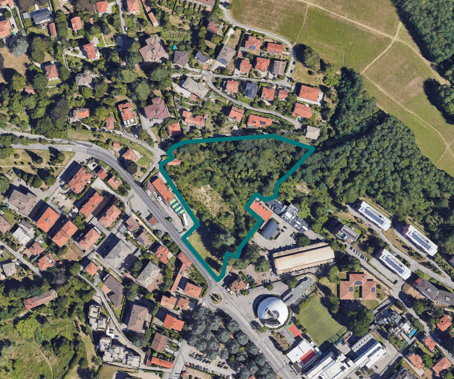
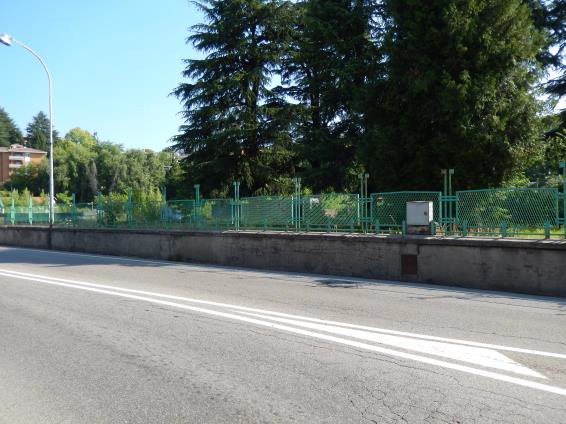
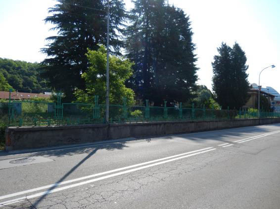
The buildable land up for auction is located in a peripheral area between Viale Padre G.B. Aguggiari and Via Mario Civelli.
It has a total surface area of 15,185 sqm.
The Territorial Governance Plan (PGT), approved by Municipal Council Resolution no. 27 of 12 June 2014 and published in the Official Bulletin of the Lombardy Region (BURL) no. 45 of 5 November 2014, includes the area within the parts of the territory designated for new development complexes, for completion or transformation, consisting of transformation areas (AT) and completion areas.
With regard to AT18 – Former Enel on Viale Aguggiari, it is included among the strategic areas affected by plans in progress. The procedural steps carried out concern the signing of the agreement on 22 December.
The area is compatible with the PTCP, as it does not affect agricultural areas, and is partially affected by the PIF, as it hosts a transformable woodland area.

IMPORTANT! The Municipality of Varese, through Municipal Executive Resolution no. 437 of 22 September 2016 (Prot. Gen. 89368/2016), initiated the procedure for a Variant to the Territorial Governance Plan aimed at reducing land consumption and redeveloping degraded land. In this context, in November 2025 the attached planning document awaiting adoption was published, which places the auction area within the ATCU 2 area, identified and described as follows:


The ATCU 2 area is located between Viale Aguggiari and Via Civelli, adjacent to the buildings of the former tram depot and the tram workshops, now restored and reused for tertiary and commercial functions.
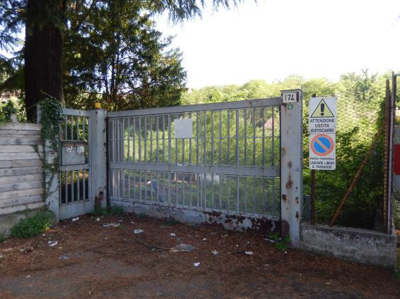
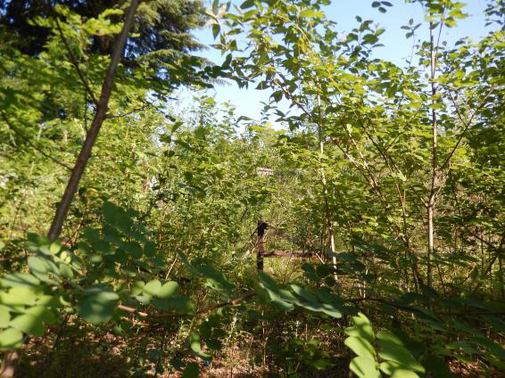
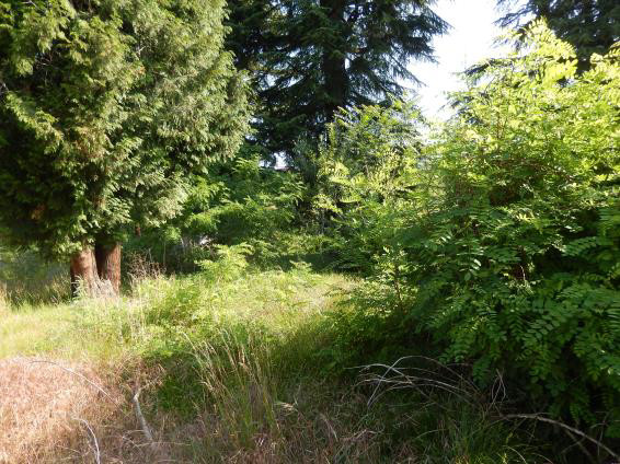
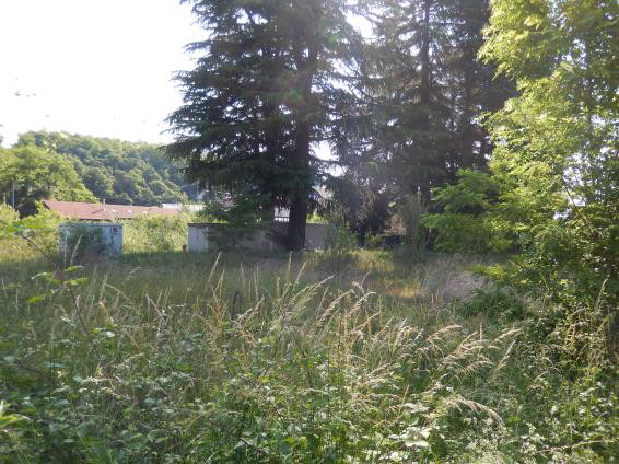
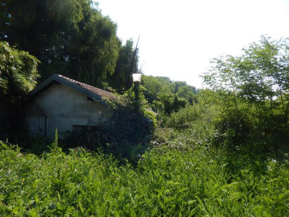
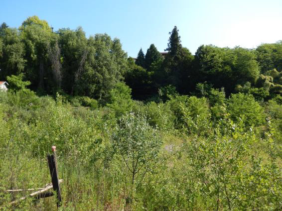
The area previously contained building structures that no longer exist; it is currently mostly open and largely includes green and wooded surfaces.

1. Urban planning indices and parameters
Territorial Surface (ST): 15,395 sqm
Maximum Territorial Utilization Index (UT max): 0.6 sqm/sqm
UT max defines the maximum amount of Gross Floor Area (SL) that can be built in the implementation of the Transformation Area, including any existing SL portions to be retained.
Mandatory minimum achievable UT: 0.3 sqm/sqm, composed as follows:
A. Base UT: 0.15 sqm/sqm
B. Mandatory equalization quota: 0.10 sqm/sqm
B1 - Bonus index deriving from the application of "B": 0.05 sqm/sqm
Maximum bonus incremental UT: up to 0.3 sqm/sqm, achievable through the application, even partial, of the following points to be defined within the PII or PA:
C. Incremental equalization quota: up to 0.1 sqm/sqm
C1 - Bonus index deriving from the application of "C": up to 0.05 sqm/sqm
D. Bonus index deriving from programs with high social inclusivity: up to 0.2 sqm/sqm
D1 – Bonus index deriving from the application of "E": up to 0.1 sqm/sqm
E. Bonus index deriving from the achievement of environmental/ecosystem performance as defined by the FEM pursuant to arts. 4 and 14: 0.1 sqm/sqm

Points C, D, E are subject to consultation with the municipal authority prior to submitting the PII or PA

Minimum surface for greenery and services of general public interest (Svs): 50% of ST
Monetizable share up to a maximum of 50% of the Svs, while in any case ensuring the placement within the compartment of the minimum allocation of statutory standards based on the functions carried out.

Morphological and functional rules
Maximum height: 5 floors and not over 19 m
Excluded uses: Industry and craftsmanship, Retail in categories C3, C4 over 500 sqm of
sales area, C5, C6 and C7, Religious services, Agricultural.
Constraints: -
Maximum settlement population: 185 units (100% residential SL out of total SL)
Estimated settlement population: 129 units (70% residential SL out of total SL)
SL for non-residential functions: 2,772 sqm/sqm (30% of total SL)

2. Ecosystem performance
Ecosystem performance related to surfaces for services of general public interest (Svs)
Minimum Permeability Index: 70% of the Svs (the AT falls within a strategic area of the Green Network)
Tree density index (DA): ≥ 4 trees/100 sqm of Permeable Surface, equal to a minimum of 216 trees
 
Ecosystem performance related to Land Surfaces (SF)
Permeability Index IP(SF) ≥ 20% SF
Tree density index (DA): ≥ 2 trees/100 sqm SP(SF), equal to a minimum of 31 trees
Coverage ratio (RC) ≤ 40% SF
Minimum FEM: 0.35
 
3. Objectives and performance of the implementation project:
The transformation of the area must take into account the pre-existing trees located primarily in the northern part of the area for the purposes of preserving and enhancing the area's ecosystem services. Pedestrian connections within the area and to the outside must be ensured, defining a principle of permeability with the surrounding context. The land area must also ensure high allocations of greenery and permeability.
The following constitute priority design objectives and guidelines of public interest in the implementation of the Transformation Area:
• The preservation and enhancement of the wooded green area in the northern part of the area in order to maintain high levels of naturalness as an element of the Green Network;
• The planning and construction of a cycle-pedestrian connection that, crossing the area, links the San Gallo neighborhood with Viale Aguggiari and Via Civelli;
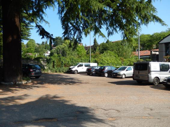
• The planning and creation within the area of a public pedestrian space capable of improving pedestrian accessibility to surrounding services and the usability of the public space currently primarily used for parking in the surrounding areas;
• Safeguarding the functionality of the nearby main road network from possible local criticalities and therefore providing an accessibility system to the area with the least possible impact on traffic flows of the existing network;
• Favoring the application of qualitative criteria in the construction of parking areas, for example through screening and the inclusion of greenery.
 
They are entirely included within areas of archaeological risk (Rules Plan, Ecological–hydrogeological constraints, Sheet 3) and for the most part within the perimeter of the built-up area, as identified by the Highway Code and by Legislative Decree of 30 April 1992 no. 285 and Municipal Executive Resolution of 28 December 2011 no. 689 (Rules Plan, Anthropogenic and infrastructural constraints, Sheet 3).
Finally, for a small portion, it is affected by the protection strip generated by the high-voltage power line, as provided for by the National Framework Law of 22 February 2001 no. 36, the Decree of the President of the Council of Ministers of 8 July 2003 and the Decree of the Minister of the Environment of 29 May 2008.

Land Registry of the Municipality of Varese, Sheet 9
Parcel 2957 - 2946

For further information, please consult the appraisal report and the attached documentation.

Details

  • Area Area:15.185 sqm
  • Lot Code Lot Code:7

Attachments


Real estate value

  • Valore di stima immobile
    Initial value of Estimate

    2.700.000,00 €

  • Valore iniziale immobile
    Current price

    142,25 €/mq


€
Offers:
info Minimum bid
EUR 1.620.000,00
info Minimum overbid
EUR 50.000,00
info Viewing
info Reduced by
-20%
info Prices indicated are VAT excluded
 
General terms Specific terms Request more info Request viewing PVP Data
ID Inserzione4545570
4aa10163-1f01-11f1-b63f-0a586442160d
Procedura
Tipologiagiudiziaria
ID Procedura639518
Tipo Proceduragiudiziaria
ID Tribunale0230910097
ID RitoNUCP
ID RegistroPROCEDURE_CONCORSUALI
TribunaleTribunale di VERONA
RegistroPROCEDURE CONCORSUALI
RitoNUOVO CONCORDATO PREVENTIVO
Num.Procedura13
Anno Procedura2014
Soggetti
  • Soggetto
    TipoSoggetto specializzato alla vendita
    Nome
    CognomeGobid international auction group srl
    Cod.Fisc.GRGNDR67A25H211F
    Email[email protected]
    Telefono0737782080
    ID Anagrafica5384971
    Soggetto VenditaSí1
    Soggetto VisitaSí1
Lotto
ID Lotto2408407
Descrizione (IT)Area edificabile a Varese - vendita telematica sulla piattaforma www.gobidreal.it n.30690.7
Primo Identificativo2408407
Codice7
GenereIMMOBILI
CategoriaALTRA CATEGORIA
IndirizzoViale Aguggiari
ComuneVarese
ProvinciaVarese
RegioneLombardia
NazioneItalia
Beni
  • Bene
    ID Bene3107852
    Descrizione (IT)IN ASTA Area edificabile a Varese, Viale Aguggiari - RACCOLTA OFFERTE    L'area edificabile in asta è sita in zona periferica ricompresa tra viale Padre G.B. Aguggiari e Via Mario Civelli.  Ha una superficie totale di 15.185 mq.  Il Piano di Governo del Territorio (PGT), approvato con Delibera del Consiglio Comunale n. 27 del 12 giugno 2014 e pubblicato sul Bollettino Ufficiale della Regione Lombardia (BURL) n. 45 del 5 novembre 2014, ricomprende l’area all’interno delle parti del territorio destinate a nuovi complessi insediativi, a completamento o in trasformazione costituite dalle aree di trasformazione (AT) e di completamento.  Per quanto riguarda l’AT18 – Ex Enel di viale Aguggiari, risulta ricompreso tra gli ambiti strategici interessati da piani in itinere. I passaggi procedurali eseguiti riguardano la stipula della convenzione in data 22 dicembre.  L’ambito risulta compatibile con il PTCP, in quanto non interessa ambiti agricoli, e parzialmente interessato dal PIF, in quanto ospitante una zona boscata trasformabile.    IMPORTANTE! Il Comune di Varese, tramite Delibera di Giunta Comunale n. 437 del 22 settembre 2016 (Prot. Gen. 89368/2016), ha avviato il procedimento di Variante al Piano di Governo del Territorio finalizzato alla riduzione del consumo di suolo e per la riqualificazione del suolo degradato. In tale contesto è stato pubblicato nel novembre del 2025 l’allegato documento di piano in attesa di adozione che inserisce l’area oggetto di gara nell’ambito ATCU 2 così individuato e descritto:     L’ambito ATCU 2 è situato fra viale Aguggiari e via Civelli, limitrofo agli edifici dell’ex rimessa della tramvia e delle officine del tram oggi recuperati e riutilizzati per funzioni terziarie e commerciali.   L’ambito presentava manufatti edilizi non più esistenti, è attualmente prevalentemente libero e ospita per buona parte superfici verdi e boscate.     1. Indici e parametri urbanistici   Superficie Territoriale (ST): 15.395 mq   Indice di Utilizzazione Territoriale massimo (UT max): 0,6 mq/mq   L’UT max definisce la quota massima di Superficie Lorda (SL) realizzabile nell’attuazione dell’Ambito di Trasformazione, includendo le eventuali le eventuali quote di SL esistente da mantenere.   UT minimo realizzabile obbligatorio: 0,3 mq/mq, cos?̀ composto:   A. UT di base: 0,15 mq/mq   B. Quota perequativa obbligatoria: 0,10 mq/mq   B1 - Indice premiale derivante dall’applicazione di “B”: 0,05 mq/mq   UT incrementale premiale massimo: fino a 0,3 mq/mq, realizzabile attraverso l’applicazione, anche parziale, dei seguenti punti da de0inire in sede di PII o PA:   C. Quota perequativa incrementale: fino a 0,1 mq/mq   C1 - Indice premiale derivante dall’applicazione di “C”: fino a 0,05 mq/mq   D. Indice premiale derivante da programmi ad elevata inclusività sociale: 0ino a 0,2 mq/mq   D1 – Indice premiale derivante dall’applicazione di “E”: fino a 0,1 mq/mq   E. Indice premiale derivante dal raggiungimento di prestazioni ambientali/ecosistemiche cosi come definito dal FEM di cui agli artt. 4 e 14: 0,1 mq/mq     I punti C, D, E sono soggetti a concertazione con l’ente comunale preventiva alla presentazione del PII o del PA     Superficie per verde e servizi di interesse pubblico generale minima (Svs): 50% della ST   Quota monetizzabile 0ino a un massimo del 50% della Svs e comunque garantendo la localizzazione nel comparto della dotazione minima di standard previsti per legge in base alle funzioni realizzate.     Regole morfologiche e funzionali   Altezza massima: 5 piani e non oltre 19 m   Funzione escluse: Industria e artigianato, Commercio nelle articolazioni C3, C4 oltre 500 mq di   super0icie di vendita, C5, C6 e C7, Servizi religiosi, Agricolo.   Vincoli: -   Abitanti insediabili massimi: 185 unità (100% SL residenziale rispetto a SL totale)   Abitanti insediabili stimati: 129 unità (70% SL residenziale rispetto a SL totale)   SL per funzioni non residenziali: 2.772 mq/mq (30% della SL totale)     2. Prestazioni ecosistemiche   Prestazioni ecosistemiche relative alle superficie per servizi di interesse pubblico generale (Svs)   Indice di Permeabilità minimo: 70% della Svs (l’AT ricade in ambito strategico della Rete Verde)   Indice di densità arborea (DA): ≥ 4 alberi/100mq della Superficie Permeabile pari a minimo 216 alberi       Prestazioni ecosistemi relative alle Superfici Fondiarie (SF)   Indice di Permeabilità IP(SF) ≥ 20% SF   Indice di densità arborea (DA): ≥ 2 alberi/100 mq SP(SF) pari a minimo 31 alberi   Rapporto di copertura (RC) ≤ 40% SF   FEM minimo: 0.35       3. Obiettivi e prestazioni del progetto attuativo:   La trasformazione dell’area dovrà tenere conto delle pre-esistenze arboree localizzate primariamente nella parte nord dell’ambito ai 0ini della conservazione e del potenziamento dei servizi ecosistemici dell’area. Dovranno essere garantite le connessioni pedonali all’interno dell’area e all’esterno, definendo un principio di permeabilità con il contesto. La superficie fondiaria dovrà anch’essa garantire alte dotazioni di verde e permeabilità.   Costituiscono obiettivi e indirizzi progettuali prioritari di interesse pubblico nell’attuazione dell’Ambito di Trasformazione:   • Il mantenimento e potenziamento del verde boscato nella parte settentrionale dell’ambito al fine del mantenimento di elevati livelli di naturalità in quanto elemento della Rete Verde;   • La previsione e realizzazione di una connessione ciclo-pedonale che, attraversando l’ambito, colleghi il quartiere San Gallo con viale Aguggiari e via Civelli;   • La previsione e realizzazione all’interno dell’ambito di uno spazio pubblico pedonale in grado di favorire l’accessibilità pedonale ai servizi circostanti e la fruibilità dello spazio pubblico oggi primariamente utilizzato a parcheggio nelle aree circostanti;   • Salvaguardare la funzionalità della limitrofa rete viaria principale da possibili criticità locali e dunque prevedere un sistema di accessibilità all’ambito il meno impattante possibile per i flussi viabilistici della rete esistente;   • Privilegiare l’applicazione di criteri qualitativi nella realizzazione dei parcheggi, ad esempio attraverso il mascheramento e l’equipaggiamento a verde.     Risultano completamente ricomprese all’interno delle aree a rischi archeologico (Piano delle Regole, Vincoli ecologico – idrogeologici, Foglio 3) e per la maggior parte nel perimetro del centro abitato, così come individuato dal Codice della  Strada e dal D.Lgs del 30 aprile 1992 n. 285 e Delibera della Giunta Comunale del 28 dicembre 2011 n. 689 (Piano delle Regole, Vincoli antropici e infrastrutturali, Foglio 3).  Infine, per una porzione ridotta, è interessato dalla fascia di rispetto generata dall’elettrodotto ad alta tensione, così come previsto dalla Legge Quadro Nazionale del 22 febbraio 2001 n. 36, dal Decreto del Presidente del Consiglio dei Ministri del 8 luglio 2003 e dal Decreto del Ministro dell’Ambiente del 29 maggio 2008.    Catasto Terreni del Comune di Varese al Foglio 9  Particella 2957 - 2946    Per ulteriori informazioni consultare la perizia e la documentazione in allegato.
    Primo Identificativo3107852
    TipologiaALTRA CATEGORIA
    CategoriaLOTTO EDIFICABILE
    IndirizzoViale Aguggiari
    ComuneVarese
    ProvinciaVarese
    RegioneLombardia
    NazioneItalia
    Bene Immobile
    • Dati catastali
      Foglio/
      Particella/
    Tipo DenunciaProtocollo
Dati Vendita
Data e oraThu 21 May 2026 at 12:012026-05-21T12:01:00
TipologiaCOMPETITIVA
ModalitàPRESSO IL VENDITORE
Indirizzovendita telematica sulla piattaforma www.gobidreal.it
CAP20148
ComuneMilano
ProvinciaMilano
RegioneLombardia
NazioneItalia
Prezzo base2.160.000,00
Offerta Minima1.620.000,00
Rialzo Minimo50.000,00
Termine Presentazione OfferteThu 21 May 2026 at 12:002026-05-21T12:00:00
Siti
  • Sito
    ID22
    Tipologiasito pubblicita
    Nominativohttps://www.gobidreal.it/
    Indirizzo URLhttps://www.gobidreal.it/
Data pubblicazione13/03/20262026-03-13

How to participate in the bidding process

The procedure is easy and intuitive.

  1. Register on Gobidreal.it

    To activate your account, enter the required data which will be the same with which you will participate in the online competitive sale and to which, if applicable, the award of the property at auction will be attributed.

  2. Place your bid

    Click on "Make an offer", enter the amount you would like to offer, download and fill out the Offer Form. Pay the security deposit. Send the signed form along with the bank transfer receipt and the required documentation. You will be notified of the receipt of the offer on the sale page.

  3. Evaluation outcome

    The offer will undergo an evaluation process. The outcome will be communicated to you via email. If your offer is the only one approved, you will be able to directly acquire the property. If there are multiple valid offers, you will be allowed to participate in an online competitive auction open only to bidders. At the end of the sale, the highest bidder will be the winner of the property.

Similar Properties