Agricultural Land for Auction in Vigo (TN)
Vigo (TN), Strada dei Ronchi
Agricultural Land di 62090 mq
AT AUCTION Agricultural and partially buildable land in Vigo (TN), Strada dei Ronchi
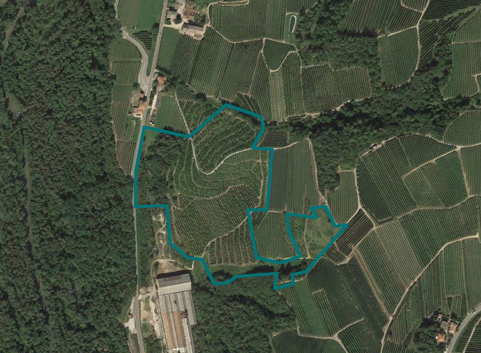
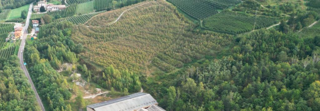
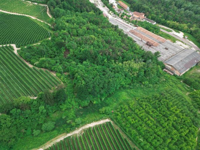
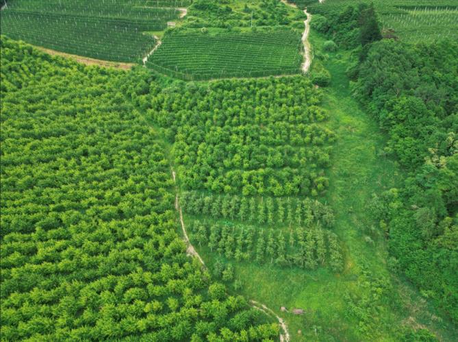
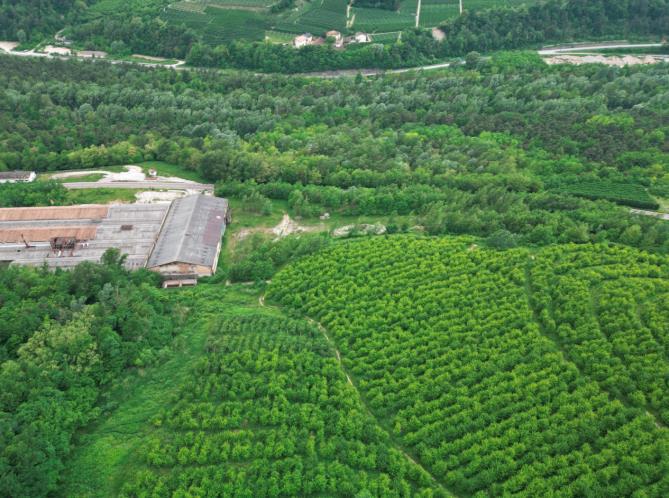
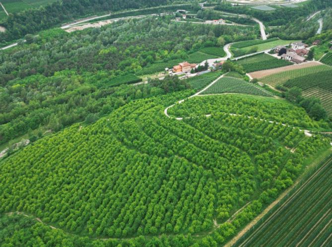
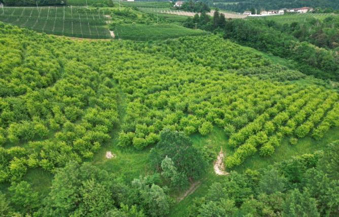
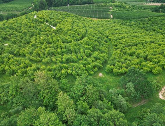
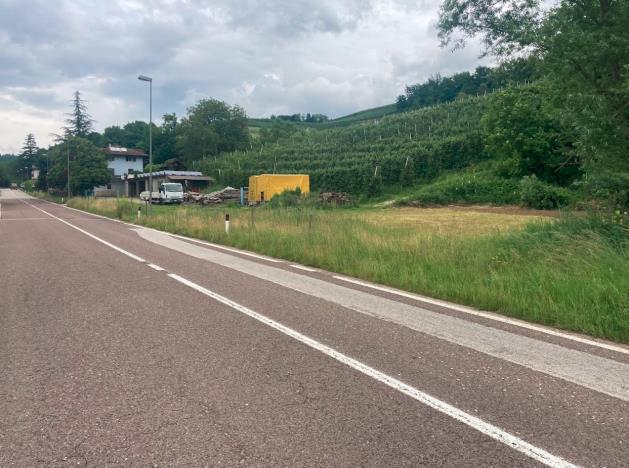
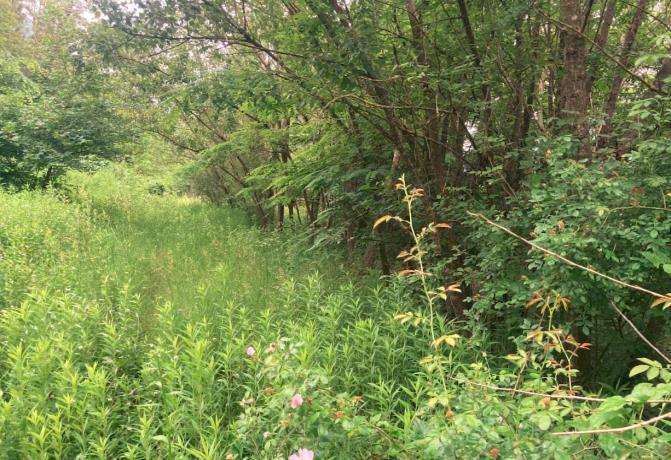
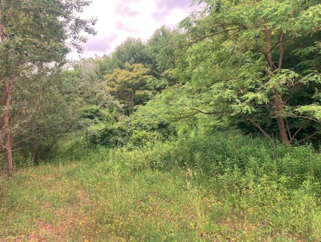
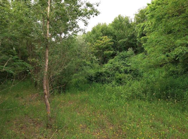
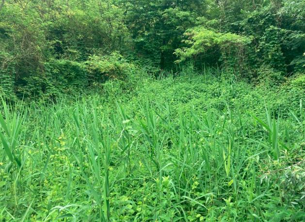
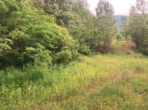
Agricultural and partially buildable land in Vigo (TN), Strada dei Ronchi, located just 600 meters from the SS43 exit, with a total area of 62,090 sqm, urbanistically classified as local and valuable agricultural land, primarily used for agricultural purposes and largely planted with apple trees and partially wooded.
The planted areas can be summarized as follows:
Zone n.1 - sqm. 9612 - Homogeneous portion planted with apple trees with a slope facing northwest with an average gradient of 20-25%
It is planted with apple trees approximately 30 years old
Within the consortium perimeter, registered for road use, not registered for irrigation
Zone n.2 - sqm. 12300 - Homogeneous portion planted with apple trees with a slope facing north/south with an average gradient of 25-30%
It is planted with apple trees approximately 30 years old
Within the consortium perimeter, partially registered for road use, not registered for irrigation
Zone n.3 - sqm. 13987 - Homogeneous portion planted with apple trees with a slope facing southwest with an average gradient of 15%
It is planted with apple trees approximately 20 years old
Within the consortium perimeter, partially registered for road use, not registered for irrigation
Zone n.4 - sqm. 6022 - Homogeneous portion planted with apple trees with a slope facing west with an average gradient of 20%
It is planted with apple trees approximately 20 years old
Within the consortium perimeter, partially registered for road use, not registered for irrigation
Zone n.5 - sqm. 9402 - Homogeneous portion of former orchard now meadow with a slope facing west with an average gradient of 25%
It is planted with apple trees approximately 20 years old
Within the consortium perimeter, partially registered for irrigation
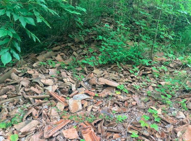
No investigations have been carried out at different excavation depths. No useful elements have been found to ascertain the environmental quality of such deposits, nor have chemical analyses been conducted to verify their environmental quality requirements.
It is not possible to exclude the presence of other materials or buried waste. No further elements are known regarding the quality of such embankments, nor have chemical analyses been conducted to ascertain their environmental quality requirements.
For the purposes of a preliminary assessment, two soil samples have been taken, as described in chapter 2.6 of the report "body n.2", which were then subjected to chemical analysis. According to the evidence from the test reports, the parameters fall within the limits set by Legislative Decree 152/06 and subsequent amendments, Title V, Annex 5 - Table 1 - Column A (sites for public, private, and residential green use). No leaching tests have been conducted.
The sale is arranged in the current state of fact and law, including urban planning, in which the aforementioned lands are currently located and must be considered forced and therefore not subject to the regulations concerning guarantees for defects or lack of quality, nor can it be revoked for any reason: the existence of any defects, lack of quality or discrepancies in the sold item, charges of any kind, for any reason not considered, even if hidden and not highlighted in the report, will not give rise to any compensation, indemnity, or price reduction.
With the transfer of the property, the successful bidder assumes all obligations related to any remediation and waste disposal actions, even if hidden, described and not in the report, and nothing can be claimed against the Procedure and/or the Auction House.
The area is served by a land improvement consortium of Toss and Vigo di Ton that manages road and irrigation.
Access is via public road p.f.1239/1 c.c. Vigo which in turn connects to the provincial road and enjoys easy internal transit routes within the property for processing purposes.
From the public road p.f.1239/1, internally within the property in question, an agricultural road managed by the land improvement consortium branches off, connecting with the municipal road p.f.1239/1 and p.f.1225 and other third-party lands. In this regard, the existing agricultural road, of which there is evidence in the P.A.T. orthophoto from 1994, as managed by the consortium and others, as well as the related paths even if not registered, are considered consolidated as exercised and deemed acquired. It will be the responsibility of the successful bidder to update and formalize new and/or modifications to existing agreements directly with the land improvement consortium or request a new irrigation concession from the provincial service responsible for water resource management.
The costs related to the types of subdivision preparatory to the sale as described in the report, which have already been deducted from the liquidation value set as the auction base, remain the responsibility of the successful bidder.
CC Vigo:
P.T.140 - P.F. 1239/3 - 353/2 - 354/5
P.T 411 - P.F. 353/4 - 367/20 - 354/10 - 367/11 - 684/N2 (*) - 684/4 (*)
P.T 486 - P.F. 353/3 - 354/N1 (*) - 367/N1 (*) - 684/N3 (* )- 354/6 - 367/19 - 354/4 - 355 - 683/2 - 684/5 (*)
P.T 357 - P.F. 684/N1 (*) - 684/2 (*) - 684/3
P.T. 576 - P.F. 361 - 362 – 363
(*) Parcels as per the draft type of subdivision preparatory to the sale attached to the report
For further information, please consult the report (Body 1 and 2) and the attached documentation.
It is possible to request all attachments to the report at the email address pec gobidreal@pec.it.
Details
Attachments
Real estate value
-
Deposit
- EUR 159.225,00
-
Reserve price
-
Minimum overbid
- EUR 10.000,00
-
Viewing
- By appointment
-
Buyer's premium
- See specific conditions
-
Prices indicated are VAT excluded
PVP Data
| ID Inserzione | 4394269 | ||||||||||||||||||||||||||||||||
|---|---|---|---|---|---|---|---|---|---|---|---|---|---|---|---|---|---|---|---|---|---|---|---|---|---|---|---|---|---|---|---|---|---|
| Procedura | |||||||||||||||||||||||||||||||||
| Tipologia | giudiziaria | ||||||||||||||||||||||||||||||||
| ID Procedura | 982009 | ||||||||||||||||||||||||||||||||
| Tipo Procedura | giudiziaria | ||||||||||||||||||||||||||||||||
| ID Tribunale | 0222050099 | ||||||||||||||||||||||||||||||||
| ID Rito | LG | ||||||||||||||||||||||||||||||||
| ID Registro | PROCEDURE_CONCORSUALI | ||||||||||||||||||||||||||||||||
| Tribunale | Tribunale di TRENTO | ||||||||||||||||||||||||||||||||
| Registro | PROCEDURE CONCORSUALI | ||||||||||||||||||||||||||||||||
| Rito | LIQUIDAZIONE GIUDIZIALE (CCI) | ||||||||||||||||||||||||||||||||
| Num.Procedura | 6 | ||||||||||||||||||||||||||||||||
| Anno Procedura | 2023 | ||||||||||||||||||||||||||||||||
| Soggetti | |||||||||||||||||||||||||||||||||
| |||||||||||||||||||||||||||||||||
| Lotto | |||||||||||||||||||||||||||||||||
| ID Lotto | 2272485 | ||||||||||||||||||||||||||||||||
| Descrizione (IT) | Terreni parzialmente edificabili a Vigo (TN) - vendita telematica sulla piattaforma www.gobidreal.it n.26933 | ||||||||||||||||||||||||||||||||
| Primo Identificativo | 2272485 | ||||||||||||||||||||||||||||||||
| Codice | 1 | ||||||||||||||||||||||||||||||||
| Genere | IMMOBILI | ||||||||||||||||||||||||||||||||
| Categoria | ALTRA CATEGORIA | ||||||||||||||||||||||||||||||||
| Indirizzo | Strada dei Ronchi | ||||||||||||||||||||||||||||||||
| Comune | Ton | ||||||||||||||||||||||||||||||||
| Provincia | Trento | ||||||||||||||||||||||||||||||||
| Regione | Trentino-Alto Adige | ||||||||||||||||||||||||||||||||
| Nazione | Italia | ||||||||||||||||||||||||||||||||
| Beni | |||||||||||||||||||||||||||||||||
| |||||||||||||||||||||||||||||||||
| Dati Vendita | |||||||||||||||||||||||||||||||||
| Data e ora | Wed 25 June 2025 at 15:01 | ||||||||||||||||||||||||||||||||
| Tipologia | COMPETITIVA | ||||||||||||||||||||||||||||||||
| Modalità | PRESSO IL VENDITORE | ||||||||||||||||||||||||||||||||
| Indirizzo | vendita telematica sulla piattaforma www.gobidreal.it | ||||||||||||||||||||||||||||||||
| CAP | 20148 | ||||||||||||||||||||||||||||||||
| Comune | Milano | ||||||||||||||||||||||||||||||||
| Provincia | Milano | ||||||||||||||||||||||||||||||||
| Regione | Lombardia | ||||||||||||||||||||||||||||||||
| Nazione | Italia | ||||||||||||||||||||||||||||||||
| Prezzo base | 1.592.249,00 | ||||||||||||||||||||||||||||||||
| Offerta Minima | 1.592.249,00 | ||||||||||||||||||||||||||||||||
| Rialzo Minimo | 10.000,00 | ||||||||||||||||||||||||||||||||
| Termine Presentazione Offerte | Wed 25 June 2025 at 15:00 | ||||||||||||||||||||||||||||||||
| Siti | |||||||||||||||||||||||||||||||||
| |||||||||||||||||||||||||||||||||
| Data pubblicazione | 21/05/2025 | ||||||||||||||||||||||||||||||||
| Eventi | |||||||||||||||||||||||||||||||||
| |||||||||||||||||||||||||||||||||

